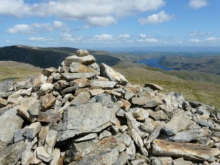
|
Mardale Ill
Bell
| Height: |
2,496 feet 761 metres |
 |
| Ranking: |
59 |
| Grid Ref: |
NY 447 101 |
| Map: |
North-eastern Area |
| Book: |
Far Eastern Fells |
| DATE |
WALK |
DISTANCE |
ASCENT |
| Wednesday, 3rd May 2017 |
Low Bridge, Shipman Knotts, Kentmere Pike, Harter Fell, Nan Bield Pass, Mardale Ill Bell, Thornthwaite Crag, Park Fell, Garburn Road (Track), Garburn Pass |
16 mls |
4,000 ft |
|
Thursday, 9th August 2012 |
Garburn Pass, Yoke,
Ill Bell,
Froswick, Thornthwaite Crag,
High Street, Mardale Ill Bell, Nan
Bield Pass, Kentmere valley |
12.5 mls |
3,000 ft |
|
Sunday, 7th August 2011 |
Kentmere, Yoke,
Ill Bell,
Froswick, Mardale Ill Bell, Nan Bield Pass, Harter Fell,
Kentmere Pike,
Shipman Knotts |
12.7 mls |
3,750 ft |
|
Sunday, 12th June 2011 |
Mardale Head, Gatescarth Pass,
Harter Fell, Nan Bield Pass, Mardale
Ill Bell, High Street,
Rampsgill Head,
Kidsty Pike,
High Raise, Red Crag,
Bampton Common, Haweswater |
14.3 mls |
4,300 ft |
|
Sunday, 24th May 2009 |
Mardale, Rough Crag, Riggindale Crag,
High Street, Mardale Ill Bell,
Harter Fell, Branstree,
Selside Pike,
Old Corpse Road |
10.5 mls |
3,800 ft |
|
Sunday, 25th May 2008 |
Kentmere, Garburn Pass,
Yoke,
Ill Bell,
Froswick,
Thornthwaite Crag,
Mardale Ill Bell, Nan Bield Pass,
Harter Fell,
Kentmere Pike,
Shipman Knotts, Green Quarter |
13.5 mls |
3,400 ft |
|
Sunday, 11th May 2008 |
Kentmere, Garburn Pass,
Yoke,
Ill Bell,
Froswick,
Thornthwaite Crag,
Mardale Ill Bell, Nan Bield Pass,
Harter Fell,
Kentmere Pike,
Shipman Knotts, Green Quarter |
13.5 mls |
3,450 ft |
| Sunday, 29th January 2006 |
Mardale Head, Riggindale,
High Street, Mardale
Ill Bell, Nan Bield Pass, Harter Fell, Gatescarth Path, Branstree,
Selside, Old Corpse Road, |
10.5 miles |
3,500 feet |
Return to Wainwrights List
|